
Dettifoss is not subtle. The water arrives fast, grey-brown with glacial sediment, and drops 44 metres into the Jökulsárgljúfur canyon with a force that you feel in your chest before you properly hear it. By volume, it is the most powerful waterfall in Europe, fed by the Jökulsá á Fjöllum river, which draws its water from the Vatnajökull ice cap far to the south. The ground vibrates faintly underfoot near the rim. Mist rises high enough to soak anyone standing at the viewpoint in the wrong wind. This is a place that earns its reputation without needing to exaggerate anything.
Why it’s worth the trip
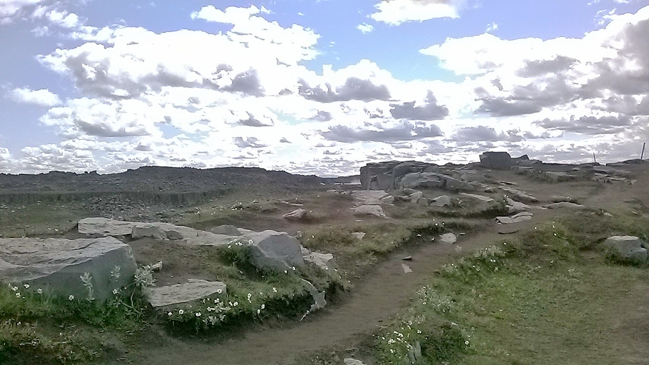
The case for Dettifoss is straightforward: raw scale, geological drama, and a landscape that looks like it belongs to an earlier version of Earth. The canyon walls are layered basalt, dark and fractured, carved over thousands of years by floodwaters from sub-glacial volcanic eruptions. The river runs milky with rock flour, giving Dettifoss its characteristically pale, churning plunge pool rather than the clear turquoise you might associate with other Icelandic falls.
Ridley Scott chose this location as the opening shot of Prometheus because it communicates something primal and indifferent. Standing at the edge, that choice makes immediate sense. The landscape is not decorative. It is the result of forces that are still active - Vatnajökull sits above a volcanic hotspot, and the river still occasionally surges after subglacial events.
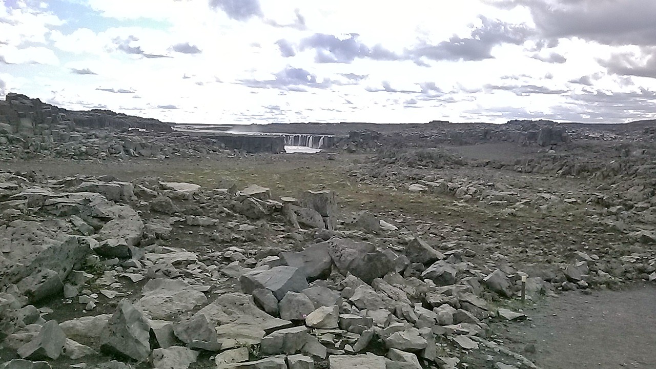
What makes the visit worthwhile beyond the main drop is the wider canyon system. Just a short walk upstream (roughly ten minutes on relatively flat ground) sits Selfoss, a broader, shallower waterfall that most visitors walk past on their way to Dettifoss and forget to properly stop at. It rewards patience. Downstream, about a kilometre and a half on the east bank path, Hafragilsfoss is smaller but sits in a deeply incised section of the canyon that feels genuinely enclosed. If you have the time and energy, that walk gives the whole visit more context.
The photography here is not easy. The mist is unpredictable. On a calm day with low wind, it drifts straight toward the east bank viewpoint and soaks camera gear quickly. Wide-angle lenses help with the scale problem, but the water colour and flat basalt can be tricky to expose well in overcast light. Many photographers prefer the west bank for its slightly more elevated angle and the dramatic foreground of black rock.
How to get there
There are two access roads, and choosing between them matters.
Road 862 runs along the east bank. It is a paved road for most of its length, making it accessible to standard rental cars without high clearance. This is the easier approach and leads to the most-used viewpoints.
Road 864 runs along the west bank. It is a gravel road, and sections of it can be rough depending on the season and recent maintenance. The west bank viewpoints look directly into the spray and give a slightly different perspective on the canyon. Check current road conditions before committing, especially early in the season.
Both roads are reached from the Ring Road (Route 1). From Akureyri, the drive is roughly two hours heading east through Mývatn. From Egilsstaðir to the east, it takes about an hour and a half. The waterfall is also commonly visited as part of a longer loop through the Jökulsárgljúfur section of Vatnajökull National Park, which includes Ásbyrgi canyon to the north.
There is no petrol station at or near Dettifoss. Fill up at Reykjahlíð (Mývatn) or at Egilsstaðir before heading in.
What to expect on arrival
Both banks have parking areas and marked paths to the viewpoints. The walk from the car park to the waterfall rim is short - under fifteen minutes on well-maintained gravel paths on the east bank. The terrain is not technically demanding, though the rock near the edge is uneven and can be wet and slippery. There are no formal barriers at many points along the rim. The standard caution applies: the edge is not fenced, the rock can be unexpectedly slick, and the mist reduces visibility in gusts.
Facilities exist at the trailheads - expect basic amenities but nothing elaborate. The national park manages the site and has done significant work in recent years to improve paths without over-engineering the experience.
The walk from the east bank car park to Selfoss and then down to Dettifoss and onward to Hafragilsfoss totals around four kilometres return if you include all three falls. That is a comfortable two-hour visit at a relaxed pace, which aligns with what most people actually spend here. If you are only going to Dettifoss and back, ninety minutes is realistic.
Sound is part of the experience in a way that photographs cannot convey. The roar is constant and directional, louder the closer you get to the gorge edge. On the east bank in particular, you hear Dettifoss well before you see it.
When to go
The waterfall runs year-round, but the access roads close in winter and the opening dates vary by year. Generally speaking, the east bank road opens in late spring, often around late May, while the west bank road may open later or have seasonal restrictions. Check the Icelandic Road and Coastal Administration (Vegagerðin) website for current status before planning around a specific date.
Summer (June-August) brings the highest visitor numbers and the best access. The light in June and July is exceptional for long evening photography sessions - true darkness barely exists, so you can visit at hours when crowds are thin without losing usable light. August tends to bring more overcast days but also dramatic sky conditions. Autumn visits in September offer the possibility of northern lights if you are staying nearby, and the crowds thin noticeably after mid-August.
Spring visits, particularly May or early June, can offer snowmelt-swollen flow volumes, though road access remains the limiting factor.
Tips and responsible-visitor notes
A few practical points that make a difference:
- Bring waterproof outer layers regardless of the forecast. The mist zone shifts with wind direction and can soak you in minutes even on a dry day.
- Protect camera gear. A rain sleeve or at minimum a cloth for the lens is worth carrying.
- Stay on the marked paths. The surrounding lava and basalt plateau contains fragile soil crusts and mosses that do not recover quickly from foot traffic. The paths exist for this reason, not only for safety.
- If you visit the west bank, drive carefully on Road 864 and turn back if conditions feel beyond your vehicle’s capability. Rental car insurance typically does not cover damage on roads that are officially designated as requiring four-wheel drive when conditions deteriorate.
- Pair the visit with Ásbyrgi. The horseshoe canyon is roughly 30 kilometres north along Road 862 and is geologically connected to the same river system. The contrast between the violence of Dettifoss and the still woodland basin of Ásbyrgi is worth experiencing in the same day if your schedule allows.
Dettifoss asks nothing of you except attention. It would be doing what it does whether anyone was watching or not.